The Museum of the Second World War was established in Gdańsk in Władysław Bartoszewski Square, on the Motława River, close to the historic city center. The museum is located in an architecturally significant space, and it is also a memorial, as it is located 200 meters from the historic Polish Post Office building in Gdańsk and just seven kilometers by water from the site of the former Polish Military Transit Depot on the Westerplatte Peninsula, attacked in September 1939.
The Museum area, occupying 17,070 square metres, borders from the west the Radunia Canal and from the south opens up onto a panorama of the Motława river. Currently, this area is on the outskirts of old Gdańsk, but soon it will be the center of a modern district presently under construction situated in the post-shipyard area.
The area on which the Museum of the Second World War stands is bordered by:
- a line representing where the now non-existent Piekary Street ran, to the west;
- a section of Wałowa Street to the north;
- Stara Stocznia Street to the east;
- the left bank of the mouth of the Radunia Channel to the Motława River, along which the now non-existent Wiadrownia Street ran, to the south.
In the Middle Ages, this area was part of the defensive structures belonging to a fortress erected by the Teutonic Knights. The fortifications were built on the site of a former stronghold belonging to a prince, and the area was transformed into the forefront of the defensive structures, separated from the mainland and the fortress itself by moats. In the mid-15th century, this area was as yet only a modest seat of the Bucketmakers Guild. On the other side of the moat there was the so-called Brabant area. In the mid-17th century, the area underwent a significant transformation. A new part of the final section of the Radunia Canal was dug, which from then on flowed into the Motława canal, not the Vistula river. As a result, this area known as Wiadrownia was limited to a small, triangular island, the shape of which influenced the urban geography of this area of the city. The roadway system consisted of the following streets: Wiadrownia, Stara Stocznia, Piekary, Wielka, Mała, and Kowale.
The original buildings on the site of the Museum, although made of brick, were poor in construction, residential housing. There was also a construction site and a timber yard on the headland between Stara Stocznia Street and the Radunia Canal. Between 1942 and 1944, a light air-raid shelter was erected in this area, which still exists today. After the centre of the city was destroyed in 1945, the area was significantly transformed. Out of the existing street layout, only Stara Stocznia has survived. The rest of the streets were liquidated after a bus depot and several squares were created.
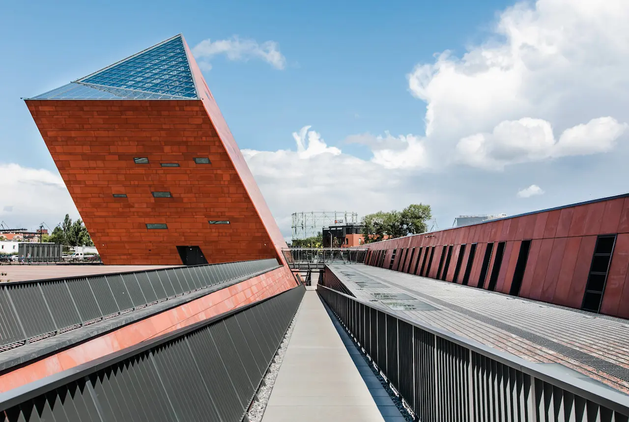
The Museum building has an overall area of 34,111 square meters. An area of over 5,000 square meters has been allocated to the main exhibition. This is designed to present the Second World War in a contemporary way, both from the perspective of the greater political events of that time but, above all, from the experience of ordinary people.
The exhibition presents not only the fate and experiences of Polish citizens, but also the experiences of people from other nations.
In addition to the permanent exhibition, the Museum also houses a thousand square meters of space for temporary exhibitions. In addition to its functions as an exhibition center, the Museum also acts as a center of education, culture and science.